Second Immigrant Generation
Descendents of Andrew Grey (ca 1785-94 – after 1861)
and 1. Mary Watson (unknown– aboard D'arcy summer, 1836)
and 2. Sarah Burgess ( ca 1810 – 11 Nov 1896)
First immigrant Generation

HARVEY SETTLement
MAPS
Links to historical and modern maps, air photos and satellite imagery of the

Atlas of
York County
New Brunswick
1878
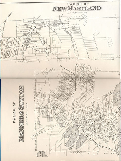
The maps of Harvey Settlement reproduced here were first published by Halfpenny (1878). They provide an excellent late 19th century record of the farms in Harvey and Tweedside as well as businesses and residences that were growing up around the newly established railroad station on the northern edge of the original settlement.
Halfpenny, H.E., Beckwith, A.C., Loggie, T.G. 1878. Atlas of York County New Brunswick. Compiled and Drawn From Official Plans and Actual Surveys. Halfpenny & Co. Fredericton, N.B. (A 1973 reprint was also produced).
FRONT PAGE


Satellite Imagery of New Brunswick

Satellite image of southern part of York County, New Brunswick showing land use. Labeled version immediately below. Source Google Earth.

Satellite image of southern part of York County, New Brunswick showing land use. Labeled version showing relative positions of original Harvey Settlement, Tweedside, Oromocto Lake and presentday Harvey Station. Source Google Earth.


Satellite Imagery of New Brunswick
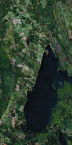
Satellite image of southern part of great Harvey area, York County, New Brunswick showing land use. Labeled version showing relative positions of communities and some lakes. Source Google Earth.

Labeled satellite image of Tweedside and Little Settlement, York County, New Brunswick showing land use. Source Google Earth.

Satellite Imagery of New Brunswick

Satellite image of Tweedside and Little Settlement, York County, New Brunswick showing land use Labeled Version below. Source Google Earth.

Labeled s atellite image of Tweedside and Little Settlement, York County, New Brunswick showing land use. Source Google Earth.